Vision: Our original destination for this outing was supposed to be Steamboat Rock S.P., but it is the time of year when the state parks here begin to allow reservations, and some parks take them while some don't. Thus we missed the beginning of Steamboat's reservation window, and that park was booked.
Revision: The new plan, even better if you ask me, was to stay at Lincoln Rock S.P. with stops at three other parks along the way to and from the ultimate destination spot.
Vision: As always, the weather forecast figured into our planning and because the last day of our trip was looking to be the best, we wanted to make a stop on that day at
Peshastin Pinnacles S.P.
Revision: The website indicated that the pinnacles would be closed beginning that very day for "dangerous tree removal." It became a stop on the first day rather than the last, dangerous trees be damned. (why dangerous trees weren't being removed immediately or at least causing the park to be closed until their removal, I couldn't say.)
The weather was a little drizzly, but not really cold. Are those the dangerous trees?!
TBGuide finds the trail entrance at this charming little door.
Vision: I had a printed the trail map which indicated the names of each of the rock formations and the difficulty of the trails around them. There are only 1.5 miles of trail, and I had it sketched out to be able to do it all without any backtracking.
Lupine was blooming everywhere.
As were the chokecherries.
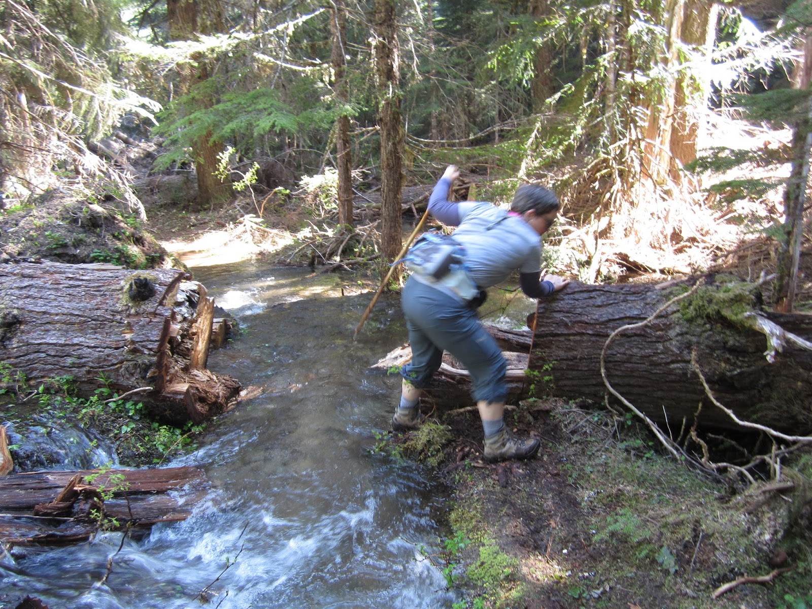
Revision: Although the light rain was abating, the trail was becoming harder to distinguish as it climbed, and our pant legs were positively soaked. We only went a little further in this direction since the trail by this time was nearly invisible.
Words of contention were exchanged when we arrived back at our starting point. Should we try to do the other half of the trails or should we bag it? I was in favor of pressing on the other direction. We were already sodden, and we were already there, I reasoned.
Near the re-vision point.
Arvie waiting for us, well away from any dangerous trees.
Turns out, it was a good decision to press on. The rain stopped altogether, and it felt like being in a greenhouse. The balsamroot liked it, too.
This soggy marmot was glad for a dry spell.
So was this one.
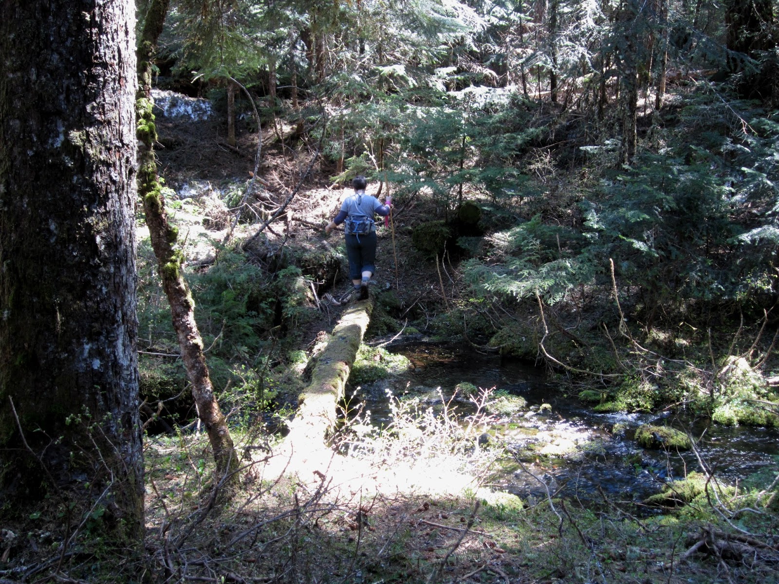
The trail opened up nicely
and zig-zagged down the hillside.
All-in-all, it was worth a stop, especially considering we didn't encounter any treacherous trees.
Re-Revision: Wen-Con, as I will now refer to it due to my undeniable coolness, does take reservations, but since we hadn't planned to stay there, we
didn't make any. It was enroute to LR, as I will now refer to it, so we stopped in and decided to stay the first night.
One of only two available spots in the only one of the two camp loops that was open. As is apparent in this photo, rain was moving in again.
Geese like rain. This goose was out of place among the gaggles of Canada geese. TBG referred to it as a Land Goose, but it is most likely a Taiga bean-goose.
The rain moved out after dinner, providing some beautiful light
and a rainbow as a backdrop for an evening stroll.
Later, I finished a puzzle I'd started on our last outing. Hi, Moo!
Our Revision decision to stay at this park was two-fold. The first fold was that part of the park was the Horan Natural Area, the trails of which allow only foot traffic, which meant that while we would pass by it on our bike ride, we wouldn't be able to go in.
It was perfect for our morning walkabout. (this bridge is part of the Apple Capital Loop Trail, which I will henceforth coolly refer to as the Ap-Cap.)
I spied these two resting in the tall grass.
It was chilly and quiet. We only saw a couple others on our way around the two-mile loop.
The signs said we might spy some beavers or muskrats, but no such luck.

Lots of these, though, even though the signs said nothing about them.
As you may have guessed, the second fold of the re-revision was to set ourselves up to ride the 10-mile Ap-Cap. Mile Zero is, inexplicably, in the middle of the bridge spanning the Columbia.
Neat-looking apple storage facility along the more industrial portion of the trail.
The trail also accesses the downtown area, which would be important to us later in the trip. On this day, I was not averse to stopping for some street food, but there wasn't any to be had.
Just one, and my official picture of, the park signs located where the Ap-Cap re-enters the park from town.
After our ride, it was time to move on. The
Vision had been to stop at
Daroga S.P., north of LR, on our first day, but as you already know, we had to
Revise that plan to see the pinnacles first. That means that Daroga happened on our second day.
This was a smallish, but very pretty park. What you didn't see in the pictures of the pinnacles, and what you won't see in these pictures, are the power lines that stretch across almost everything in this area making some of the views less than spectacular. It is, after all, where the Rocky Reach Hydroelectric Dam is located. Fishing seems to be the primary activity at this park.
A nice paved trail runs the length of the park, almost three miles long round trip.
TBG spotted this slithering along the asphalt near the boat launch.
It was just a harmless bull snake. Whew!
Is this still just the second day?
We didn't get a shot of Arvie in the space, but this is a shot of our view. It also perfectly encapsulates the weather pattern during the whole trip of rain, sun, rain, sun. There were plenty of people at this park, but it is laid out nicely and it didn't feel crowded at all.
We didn't do much more for the rest of the day than take a long walk around the park. Here TBG poses by the viewpoint constructed to showcase the park's namesake. It seems they didn't account very well for the growth of the trees which sort of obstruct the view. Let me help you with that.
Hello, Mr. Lincoln. You rock.
The only other activity of note was that I was excited to learn the showers at this park accepted tokens, and I still had two left from a long-ago trip that I needed to use up. I also had my brand-new RV shower bag ready to go for the first time. I had the facility all to myself, and I dropped in the token, and cranked the handle to HOT. Then I stood shivering in only my flip-flops with my hand in the ice-cold stream for all three minutes of the token's time. I tossed the second token back in my shower bag, put my dirty clothes back on, and stomped back to the RV. Stupid shower!
The next day we rode the Rocky Reach Trail which starts at this park and connects to the Ap-Cap, five miles south. We had to wait until noon for the trail to open because they do agricultural work this time of year along the trail and users have to wait for that to be finished. We didn't really get any pictures because we were too busy riding and beating the next rain squall.
Later that afternoon, when the sun came back out and warmed things up again, I took a walk by myself. I found some little friends.
This cutie hardly seemed alarmed by my presence.
Look at that adorable little ear!
While I was communing with the marmots, TBG was patiently scouring the hills across the river from camp for wildlife.
And he found some! Bighorn sheep, to be exact. Without binoculars, they would not be at all visible from the park, and even then, they were
very hard to spot. Good eye, TBG!
For our last full day we planned to ride both the Rocky Reach Trail and the Ap-Cap, 20 miles altogether. The morning was nice and sunny, but we watched dark clouds roll up through the valley, as the noon trail-time approached. We stuffed our raincoats into the backpack and rode into it anyway.
The sky looked angry in some parts, but miraculously we only got a few sprinkles for the whole ride.
Here I demonstrate to TBG how easy it is to get the water bottle from my new waist pack. Smooth, eh?
I needed to get to a store, and this cool bridge over the railroad yard was a perfect connection to town.
Not long after crossing this bridge and riding up through town, we came upon the Public Market again, where they were having some sort of BBQ contest. We're morons, and we didn't stop to sample any of it.
By the time we were back on the Rocky Reach Trail, the sun was out. There was a headwind for the last (uphill) mile which made it feel like riding in pudding.
Lucky us, we managed to just miss the heavier rain again, and we were snug in the RV for the rest of the evening. I wished I'd had some BBQ, though.
On the last morning, I was scouring the hills for the sheep, and I found 'em!
This is a blown-up
revision of the earlier photo. Sorry it's blurry, but not bad for a point-and-shoot camera from at least a mile away!
We took our morning walk around the nearly-deserted park, lamenting that there would be fewer people and better weather now that we were leaving.
Thanks for visiting! Please come again!