Do not fret, my friends, the Great State Park Grand Scheme has not been abandoned. I'm almost certain I can hear your collective sighs of relief. It's just that sometimes there are other places to go and things to see. Today, because we'd planned to drive north to look at a car that could possibly become our future toad, TBG also found us a hike to do while we were in the area.
Now, what I'm certain I hear is all of you saying to yourselves, "What the what is a 'future toad'?!" Toad is common parlance for a vehicle that is pulled behind an RV (from towed vehicle.) I did not make this up. I wish I had. Sometimes these vehicles are called dinghys, but I have an awkward childhood association with that word, so toad it is!
Today's hike was to Mt. Erie in the Anacortes Community Forest Lands. The forecast was Partly Sunny. The meteorologists got the Partly part right.
We found the parking area easily enough. I neglected (again!) to take a photo of the map at the signboard, thinking that the trail would just lead up to the summit. It did, and it didn't.

It led up, all right. And then it went up. After that, there was a short section of up, followed by a stretch of up.

There were a few cool things to see along the trail of upness, like this wall full of miniature waterfalls.

All the trails here are marked by only numbers, no words. We stuck to #215 figuring that even if it didn't get us to Mt. Erie, it would at least prevent us from getting lost.

It was around this viewpoint that we encountered some youngsters who advised us that we were on the right track to reach our destination.
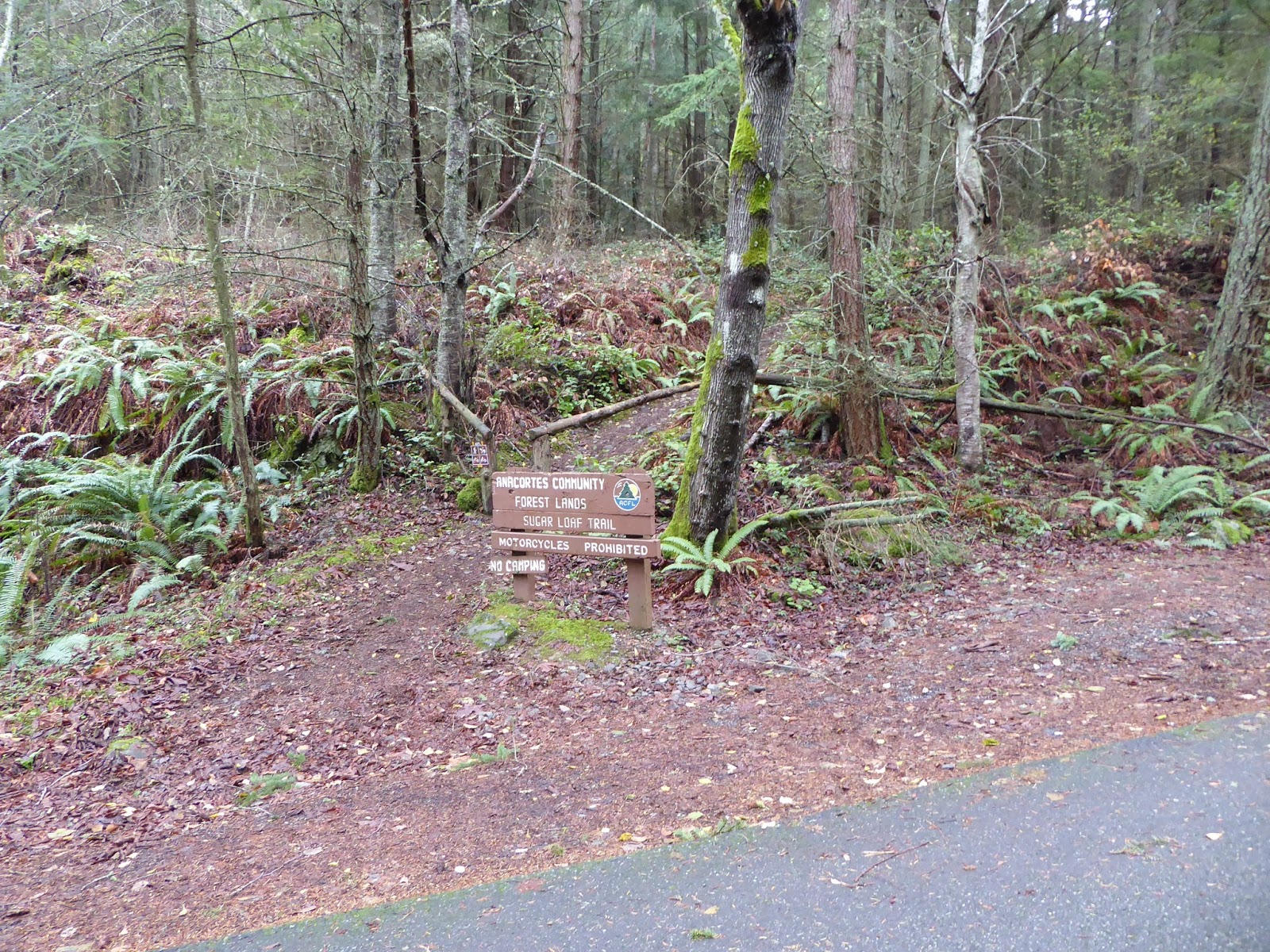
Trail #215 dumped us onto the road, indicating that we'd been hiking around the perimeter of Sugarloaf Mountain. It was the first sign we saw with actual names of trails on it.

Just a short way up the road, the trail ducked back into the woods. The road goes all the way up to the summit, but we didn't know that at the time. It became important a little later, though.

Hey, look! More signs with actual words on them!

As it happens, you can skip the trails and just drive straight up to the top. This is the walkway to one of the overlooks.

This is the view from the overlook. The Sunny part of the forecast was trying its best to be true. The wind is ridiculous up here, but if you wanted to withstand it, you could watch the planes taking off from Naval Air Station Whidbey Island. We've both seen plenty of planes taking off, so we opted to not catch our death watching more.

Eagle statue at the summit park. I think it's an eagle. There was a sign explaining what it was but I didn't really read it. Sorry sign and statue maker-people!

Another of the overlooks.

Not much of a view from here. I think the trees were quite a bit shorter when this was constructed. I did think it was cool how they melded the asphalt to the natural rock, though.

We opted to take the road back down rather than retrace our steps through the steep woods in order to protect TBG's knee, being only two weeks out from knee surgery. Even so, the road was a 15% grade, but just under two miles. The fall colors were making a brave last stand.
On the way to inspect the potential toad, the Sunny part of the forecast came shining through.
Of course it did.
The search for a suitable toad and sunnier days continues...