Sometimes, no matter how thoroughly you plan, something gets overlooked. Actually, that's not an entirely accurate description of what happened. I have "camera chargers" on the printed list of RV essentials. I checked that box off dutifully when I loaded Arvie for this trip. The problem was that the camera chargers that I thought lived exclusively in the rig had found their way into the house and that is where they were when we discovered both cameras had little life left in them. It would be a bit before we realized this, though, so let's begin at the beginning when we were still blissfully unaware that we wouldn't be able to take pictures with the carefree abandon we normally do.
The primary destination for this trip was a state park on the Columbia River, but there were others along the way to see, which, as you've probably noticed is our modus operandi. The route of this trip took us through Yakima, and everyone knows that if you're going through Yakima, a stop at Miner's Burgers is a must.

One of my general internet rules, if I haven't mentioned it before, is that I don't take pictures of the things we eat. Most non-professional online pictures of food look disgusting -- this is why food staging is an actual career. Because I don't like to see those types of pictures, I rarely inflict them on others. So, here is a picture of my delicious peanut butter shake, which went very well with the bacon-bleu burger and onion rings.
Next stop was across town to the first state park on the list and where we paused to eat our lunch and stretch our legs.

This park derives its name from the Yakima Sportsman shooting club that donated the land to the state for game management and preservation. It is a really pretty park, and while it wouldn't be a place I'd choose to camp, it would be a great place for locals to find a peaceful respite.

We took a short walk on the Dike Trail, which would be a great place for a bike ride or a run.

Then we took the nature trail around one of the ponds.

They say this park is home to over 140 species of birds. 139 to go!

One type of turtle. Maybe the only type at this park. I wouldn't know since none of the info available discusses how many types of turtles live at this park. Are there turtle-watching clubs? There should be.
As you can see from these photos, the weather was quite nice, but this was about to change and, unfortunately, right when we really needed it not to.

In the cute little town of Goldendale is this unlikely observatory. The short story is that in the 1960's four amateur astronomers decided to build a big telescope in Vancouver, WA. They successfully did so, but there was too much light pollution and cloud cover there, so partly by design and partly by happenstance, they landed in Goldendale. There is more to the story, but this blog is all about me, not them, so you'll have to look up the story your own self.

Unfortunately for us, who were there for the 2 p.m. solar show, Goldendale sometimes also experiences cloud cover. When we pulled in, we were the only vehicle in the lot, and I was sure we'd feel like big touristy dorks fresh out of their RV for the Solar Show!. Other people soon arrived, saving us from complete dorkdom.
A nice, freshly-graduated astrophysicist gave a slide-show presentation all about the sun and lightwaves and such. When she spoke of the temperature of our sun, I interrupted to ask, "How do we know what the temperature of the sun is?" Roughly translated she said, "A mile underneath the Earth in Japan, there are a bunch of floating silver balls that can tell us how fast, at what angle, and from which part of the sun come these particles called neutrinos. And then we can tell the temperature from that!" Oh, okay, astrophysicist girl. Whatever you say.
What she really meant to say is, "Google 'neutrino detector'." I encourage you to do the same if you have a burning desire to know the temperature of the sun. Burning desire -- get it?

The night-viewing telescope. The ranger had it focused on the windmills across the hills, and we all got a turn climbing up the ladder to see them. Other than listening to the talk about how the telescope and the observatory came to be, it was the only thing they had to entertain us under the cloudy skies.

But, wait! The clouds were breaking up. They were going to fire up the solar scope after all!

The little dome to the left is the solar scope. I mistakenly thought that the Solar Show would include being able to look through the actual solar scope. Sadly, no. While they did get the scope focused on the sun, we only got to see the live feed in the theater room, and didn't get invited into the solar scope dome. The other thing I learned is that the sun goes through 11-year periods of alternating activity, and we are two years into an 11-year period of relative inactivity. That is not, of course, the fault of the very enthusiastic employees of the observatory, and hats off to them for seemingly loving their work and happily sharing their knowledge with our ragtag group of traveling dorks.
Next stop was a place that is officially part of Maryhill State Park, but isn't physically connected to it. (more on that sort of thing later)

It's a to-scale replica of Stonehenge, built by Sam Hill in 1918 as a memorial to WWI veterans (in a still-ongoing war of the time.) There are plaques on the inside walls of the stones with the soldiers' names and dates. While there are great views from here, it's a rather sad place as you would expect from a war memorial. We only spent a few minutes here, then motored down into the state park proper.

This is another park at which you can camp, but unless you're a windsurfer or fisherman, there isn't really anything else to do here.

What we did here was take a short walk around the park. The website says there is 1.1 miles of walking here, but that only seems possible if you wanted to keep walking in circles around the parking lot. This little beach area was completely comprised of smooth stones, all perfectly shaped for skipping. We did that for a little while, The Big Guy laughing at my first attempts which were all ploppers.

The other thing we did here was feed the poochie and finish our Miner's meals for dinner.
Then it was on to our first overnight destination.
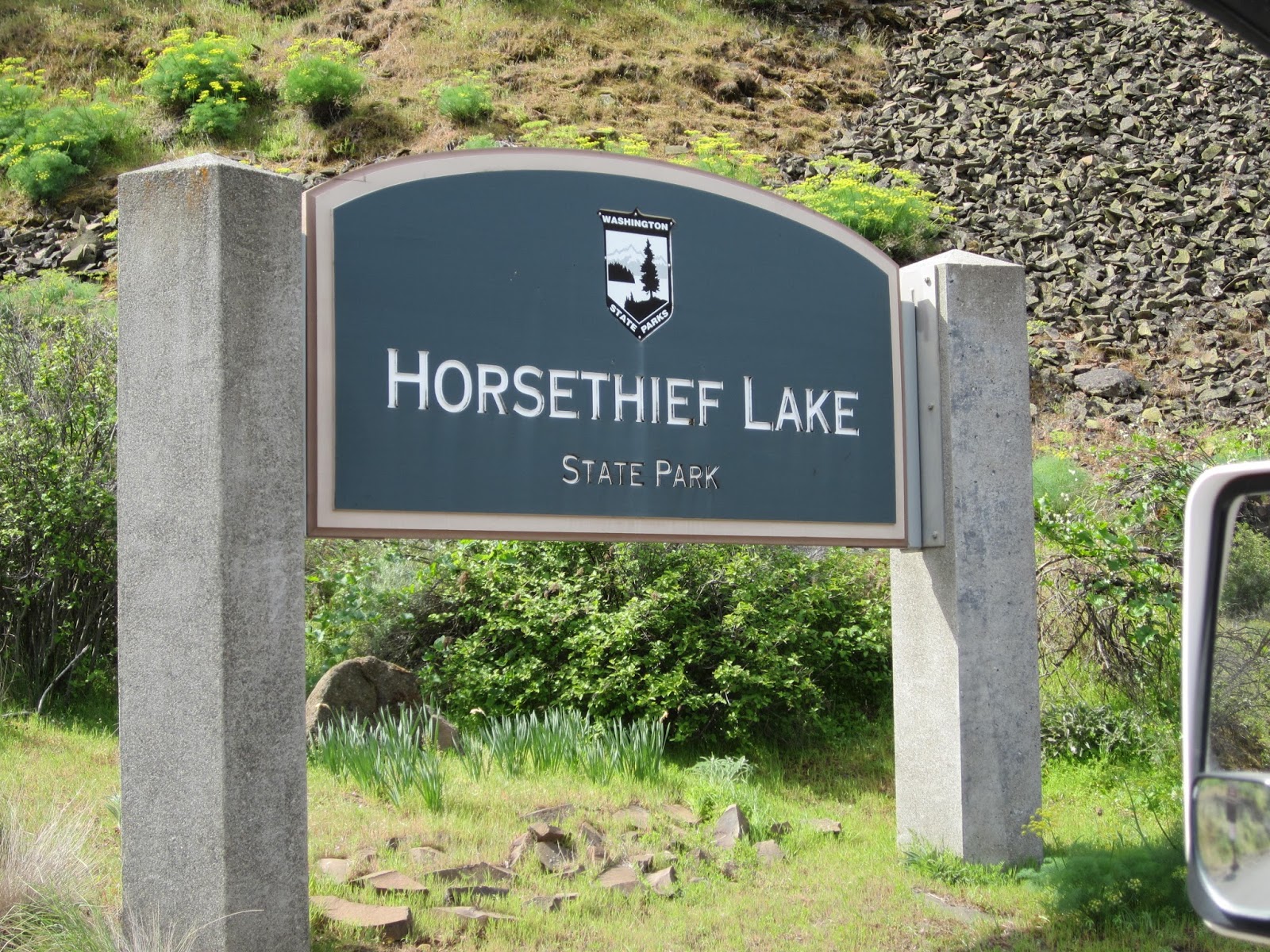
Horsethief Lake State Park.

No, wait, I mean Columbia Hills State Park.
It used to be called Horsethief, but is now not. I don't know why.

The park's lake is still called Horsethief Lake, and the butte we would later visit for a hike is still called Horsethief Butte. I should have asked the ranger, but I forgot.
As TBG was getting the rig all hooked up, he sort of let out a little "Oh, no." when he opened the big storage drawer. When I asked what was wrong, he brushed me off, but later as I was getting coffee water ready for the morning and observing it seemed cloudy, he confessed he'd forgotten the water filter somewhere in Las Cruces.

This is not a large park, but it is a very pretty park, and we were surprised at how few people were around on such a nice-weather weekend. One of my favorite things was this row of lovely lilacs (my favorite flower) lining the drive. I had to resist the urge to pluck a bouquet of them.
A photographer-camper we chatted with briefly told us to be sure to look up into the trees later to see all the critters that came to visit in the evenings at this park. As evening fell, I kept peering out into the trees, eagerly awaiting the arrival of some critters.

Look out! There's one now!
Oh, sheesh, I felt like such a gullible dork. There were several of these "critters" in the park -- this cougar, a bear, an owl, geese. It was fun to "hunt" them on our park walks.

Spot the real critter in this photo. Hint: Yellow-bellied Marmot.
Other than a stroll around the park, we mostly just tucked in for the evening.

Wake up! Time to do stuff!
One of the frustrations we've had with some of the state parks is when hiking trails that are officially part of a park are not physically connected to the actual park. This was the case with both of the hikes we wanted to do here. The internet is a life-saver in circumstances like this, and we were prepared.

We've had a couple motorcycles for awhile now, but this was the first RV trip on which we've taken one along. The trail access for this hike is only about 1/2 mile from the park, but being in the gorge, it is supremely windy. Combine the wind with slick hiking pants, a loaded backpack, and no back rest on the bike, and this was a 1/2 mile of terror for me. What made it even more special was that when we arrived at the parking lot, I realized I'd forgotten to bring the parking pass, so we had to go back and get it, making it 2 miles of terror total. Later we would discover that we were actually over the weight limit for the bike, but we don't really need to dwell on that.

The Terror Trip was worth it for the Crawford Oaks hike. Balsamroot (yellow) and Lupine (purple) blanketed the hills of this rolling 6.65mi hike.

Mt. Hood (over my head) was visible for most of the hike.

Such a nice change to do a hike that's not all about climbing.

It was a wonderfully warm day, but the wind can be brutal, and we alternated between jacket and no-jacket for most of the walk.

Beautiful stream crossing. There were some nice little pools that I can imagine would be great for hot feet at the height of summer.

The Big Guy would like you to know he took this picture.

He would also like you to think he took this one.

Back to camp. As you can see, there were only a few other campers around, making things (except for the train -- there always seems to be a train nearby -- and the alarm at the ranger station later) quiet.

A not-so-great pic of the thirteen goslings and four parents. So cute!
For Saturday, we had "reservations" for the Pictograph Tour in the park. Short history: the river people of long, long ago made petroglyphs (carvings) and pictographs (paintings) on the rocks of the gorge. When the Dalles Dam was being built, they relocated the petroglyphs to the state park area to save them from being drowned in the new lake. There is a short paved trail open to the public to view them, but to see the original pictographs you have to go on a guided tour behind a locked gate.
Again, I though we might be the only dorks ones on the tour, but once we got down to the gate, we were surprised to see a lot of others ready to go. The guide was a nice fellow who had grown up in the area. He passed out free bottles of water, stressing the importance of hydration on a hot day. He was a wealth of information, obviously loved giving the tours, and we so appreciate the folks who give their time freely at places like this.
I wish I could say the pictographs themselves were more interesting, but neither of us felt they were. The area is beautiful, the weather was spectacular, there was a pair of bald eagles perched above us on the rocks, and no one got bitten by a tick or a rattlesnake, so it was a nice time overall. TBG has serious doubts that the drawings are as old as they claim, and since they are sacred, carbon-dating is disallowed. My favorite part of the tour was that one theory posits the drawings are actually shaman advertisements to let local people know they were in the area if anyone needed some potions or healing or some such. It rang so true of human nature to me. Advertising! Not mystical, not religious, not aliens, but billboards!

Posing by the piece de resistance She Who Watches.
The next activity was to button up the RV and scoot down the road to the other hike at Horsethief Butte. Because it was already lunchtime and parking was limited, there was no place to park at the trail head. Phooey! We decided to motor across the river into The Dalles to see if we could find a store that sold charging cords. Nope.
Back to the trail head where a spot had opened up!
This butte is a very popular rock-climbers mecca, and there were many of them all over the rocks. The trail around the base is unremarkable, but does end at a nice view point high above the river. There was a more difficult trail indicated on the map, and we veered into the rocks on our way back around. How cool it was! I think calling this a "butte" isn't technically correct since it doesn't have a "relatively flat top." Instead, there are natural paths through the rock walls. As we came through one section, TBG pointed out a fat little lizard sunning on a rock, and I whipped out the camera.
Dead battery at last.
Thinking quickly, I took out my flip phone -- yeah, I said flip phone. Wanna make something of it?

Not bad for a flip phone, eh?
I had doubts at the time that the photo would turn out, so I didn't take any more with the phone, and I regret that now because we have none of how cool it was in there. You'll have to go see for yourself.
On the way to our last stop, we passed by St. John's Monastery I'd seen it mentioned online while planning this trip, but a recommendation from my sister-in-law, convinced us we should stop for some treats on the way. Freshly made and delicious, enough for lunch, dinner, and even breakfast the following morning.

Our Saturday afternoon/overnight destination.

There was only one other RV here and one tent. Except for the road noise, which wasn't too bad, it was very quiet. We laid low for the rest of the day, enjoying some deer and a turkey that passed through.
This park isn't the prettiest or best-maintained, but we met a very nice park worker, Dillon, who was working hard to keep things in order. He had good advice about where we could hike the following day, and as we set out Sunday morning following his directions, he was actually waiting and watching for us with maps he'd printed out to show us just where to go.

Our goal was the picnic meadow.

Mt. Hood trying to hide between those two evergreens. We saw about 20 deer total on the way up to this meadow and zero other people. We also tried to locate the gobbler we kept hearing, but he was too wary for us.

Dillon had told us about the white oak and how big ones like this are hundreds of years old. There were even little symbols on the maps indicating "special trees."

Posing by a very, very old oak tree.
The last photo of the trip, taken with a phone, since the other camera gave up the ghost after the other tree photo. Otherwise this post would be even longer.
Can you imagine?!